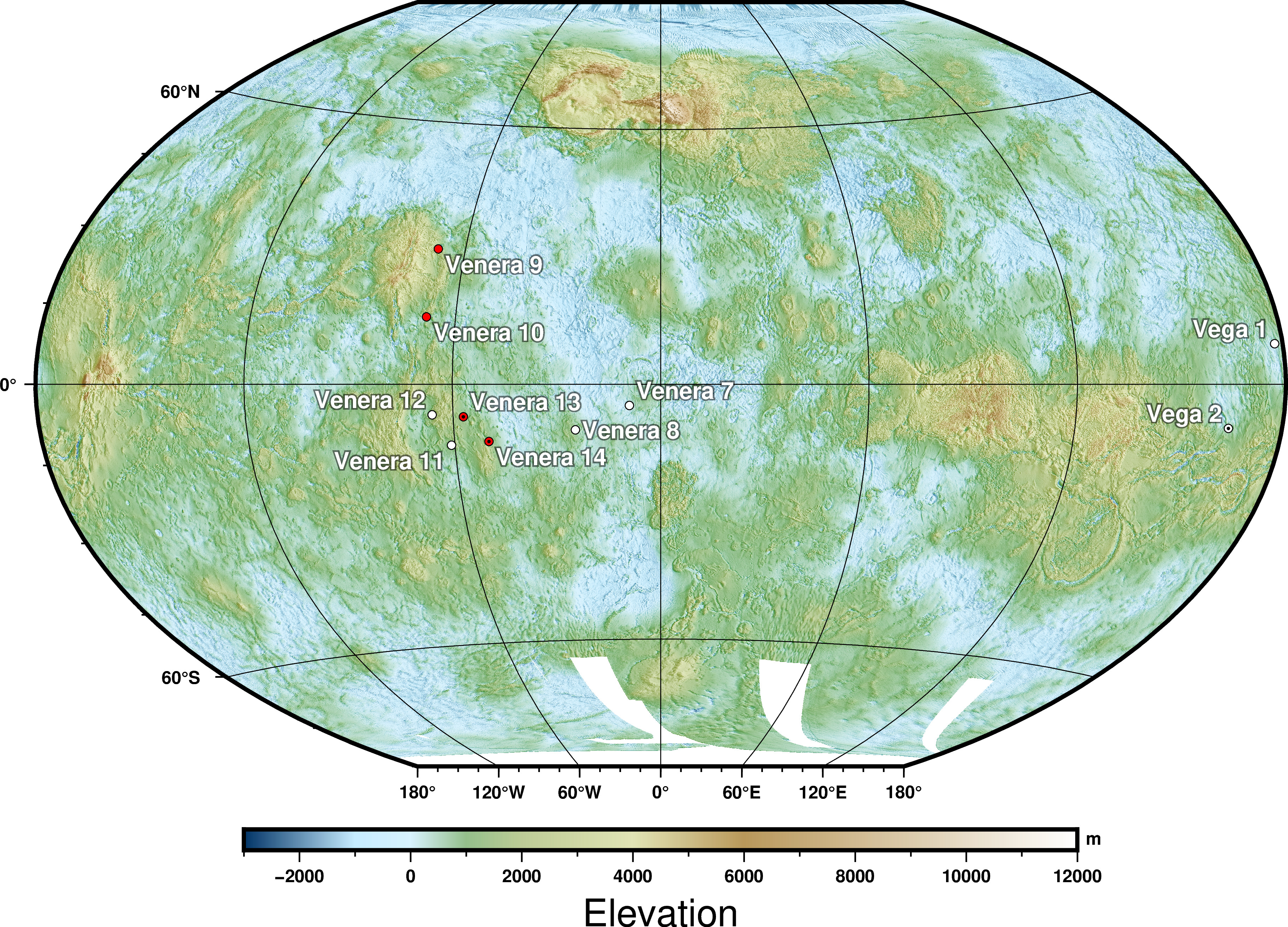
Датотека:VenusLanderTopo.jpg
Pređi na navigaciju
Pređi na pretragu


Veličina ovog prikaza: 800 × 576 piksela. 6 drugih rezolucija: 320 × 230 piksela | 640 × 460 piksela | 1.024 × 737 piksela | 1.280 × 921 piksela | 2.560 × 1.842 piksela | 3.650 × 2.626 piksela.
Originalna datoteka (3.650 × 2.626 piksela, veličina datoteke: 4,95 MB, MIME tip: image/jpeg)
Opis
| Opis | |
| Datum | |
| Izvor |
Source: A combination of the following Public Domain data sources |
| Autor | Zamonin |


Licenciranje
Ja, nosilac autorskog prava nad ovim delom, objavljujem isto pod sledećom licencom:
Ova datoteka je dostupna pod licencom Creative Commons Autorstvo-Deliti pod istim uslovima 3.0 Unported.
- Dozvoljeno je:
- da delite – da umnožavate, raspodeljujete i prenosite delo
- da prerađujete – da preradite delo
- Pod sledećim uslovima:
- autorstvo – Morate da date odgovarajuće zasluge, obezbedite vezu ka licenci i naznačite da li su izmene napravljene. Možete to uraditi na bilo koji razuman manir, ali ne na način koji predlaže da licencator odobrava vas ili vaše korišćenje.
- deliti pod istim uslovima – Ako izmenite, preobrazite ili dogradite ovaj materijal, morate podeliti svoje doprinose pod istom ili kompatibilnom licencom kao original.
Istorija datoteke
Kliknite na datum/vreme da biste videli tadašnju verziju datoteke.
| Datum/vreme | Minijatura | Dimenzije | Korisnik | Komentar | |
|---|---|---|---|---|---|
| trenutna | 12:14, 22. septembar 2023. | | 3.650 × 2.626 (4,95 MB) | wikimediacommons>Zamonin | new color scheme |
Upotreba datoteke
Sledeća stranica koristi ovu datoteku: